PROPERTY OVERVIEW
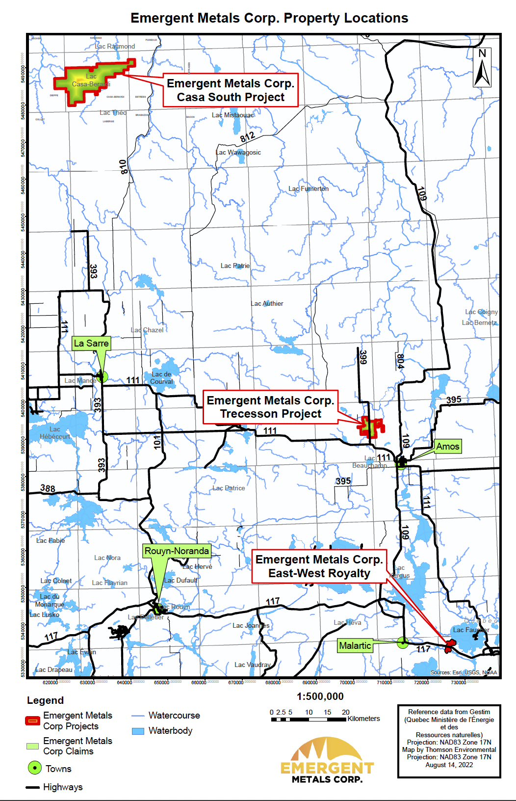
| LOCATION | 13 km west of Amos, Quebec in the Abitibi Region of Quebec, in Trecesson and Dalquier townships |
| NUMBER OF CLAIMS | 56 |
| PROPERTY SIZE | 1,903 ha |
| OWNERSHIP | 100% |
| PROPERTY STATUS | Available for option, joint venture, or sale |
| UNDERLYING ROYALTIES | Exploration Carat Royalty, Group Leblanc Royalty, Leblanc Royalty, and Robert-Audet Royalty, each a 2% NSR, applicable to separate claims groups, Emergent may buy back 1% of each NSR for CDN$1.0 million at any time |
| EXPLORATION COMPLETED |
|
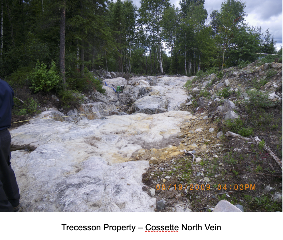
| KEY EXPLORATION TARGETS | North and South Cossette Vein Systems |
| NI 43-101 TECHNICAL REPORTS |
NI 43-101 Technical Report Pertaining to the Trecesson Property, Abitibi Area, Quebec, Canada, Amos Region, NTS 32D/09, Prepared for Knick Exploration Inc. by Donald Theberge, P. Eng. M.B.A., January 20, 2012, Updated on March 25, 2013 |
| MINERAL RESOURCES | None yet defined |
| EXPLORATION HIGHLIGHTS |
|
INTRODUCTION
The Trecesson Property (“Trecesson” or the “Property”) consists of 56 mineral claims totaling 1,903 ha. The Property, 100% owned by Emergent, subject to underlying royalties. It is located 13 km west of the town of Amos and about 50 km north of the Val d’Or mining camp.
Historic exploration on the property dates back to 1925. Recent exploration was done by Knick Exploration Inc. (“Knick”) including two drill programs, one in 2011 and one in 2017. The first drilling program consisted of 121 drill holes totaling 3,473.9 m and the second program consisted of 33 drill holes totaling 3,220.6 m. This equates to an average hole length of 43.4 m per hole. Drilling focused primarily on two target areas – the Cossette North and South Veins.
Selected significant intercepts (>10 g/t and 1 m width) drilled by Knick include:
- 10.55 g/t Au over 1.2 m from a depth of 8.80 m to 10.0 m in hole TR-11-19
- 14.22 g/t Au over 3.8 m from a depth of 23.00 m to 26.80 m in hole TR-11-61 including 33.1 g/t over 1.5 m from a depth of 23.00 m to 24.50 m
- 13.65 g/t Au over 1.45 m from a depth of 6.80 m to 8.25 m in hole TR-11-78
- 20.50 g/t Au over 1.10 m from a depth of 17.60 m to 18.70 m in hole TR-11-111
Knick’s samples were sent to Laboratoire Expert Inc. (Expert Laboratory Inc.) in Rouyn-Noranda, Quebec for analysis. Fire assay and metallic sieve methods were used analysis. QC/QC measures in Knick’s drilling program included blanks and standards. Emergent considers these results to be historical and it has not yet completed sufficient work to independently verify these historic results.
Additional information on the property can be found in the NI 43-101 Technical Report Pertaining to the Trecesson Property, Abitibi Area, Amos Region, Quebec by Donald Théberge, P.Eng., M.B.A. Dated January 20, 2012, Updated March 25, 2013, and found under Knick’s corporate filings at www.sedar.com.
LOCATION & OWNERSHIP
On September 27, 2022, Emergent announced it had acquired the remaining 50% interest in the East-West Property near Val d’Or and 100% interest in the Trecesson Property near Amos from Knick Exploration Inc. The Transaction was completed as part of a Commercial Proposal made under the Canadian Bankruptcy and Insolvency Act by Knick with its creditors. The Proposal was agreed to by a vote of creditors and subsequently approved by the Superior Court of Quebec, Abitibi District. Emergent paid the Trustee C$160,000 in return for Knick’s interest in these properties. In addition, operations loans totaling C$110,000 advanced to Knick were considered as part of the acquisition cost of the East-West Property and Trecesson Properties by Emergent.
The Property consists of 56 mineral claims totaling 1,903 ha. The Property, 100% owned by Emergent, subject to underlying royalties. It is located 13 km west of the town of Amos and about 50 km north of the Val d’Or mining camp. Geographically, it is located on NTS sheet 32D/09 and is in the townships of Trecesson and Dalquier.
The Property is easily accessible by paved roads, as follows for the western part: from the western limit of the town of Amos, take provincial Route 111 westward for approximately 9 km, then turn north and follow the road to St-Nazaire-de-Berry for about 3.5 km. This latter road crosses the Property in a north-south direction and runs some 150 m west of the Cossette showing.
Parts of the property are subject to underlying Net Smelter Return (“NSR”) royalties. These include the Exploration Carat Royalty, Group Leblanc Royalty, Leblanc Royalty, and Robert-Audet Royalty, each a 2% NSR, applicable to separate claims groups, Emergent may buy back 1% of each NSR for CDN$1.0 million at any time. Any claims originally staked by Knick or staked by Emergent are not subject to any royalty.
GEOLOGY & MINERALIZATION
The Property is located in the Abitibi Volcanic Belt of the Superior Province of the Canadian Shield. The Abitibi Belt extends for nearly 550 km in a west-east direction from Timmins, Ontario to Chibougamau, Quebec. It is host to a variety of precious and base metal deposits including the Timmins, Kirkland Lake, Harker-Holloway, Noranda, Val d’Or and Chibougamau mining camps.
The Abitibi Volcanic Belt is composed of a complex assemblage of interbedded volcanic and sedimentary rocks, intruded by a variety of ultramafic to felsic intrusives. The rocks are Archean in age and have been metamorphosed to the greenschist facies. Numerous Late Precambrian diabase dykes cut the rocks of the belt. The rock units generally strike west-east, have near vertical dips and are highly faulted and folded. Geological interpretation of the Abitibi Belt is complicated by the wide scattering of outcrop exposures in most areas and the complex underlying structural relationships.
The Property covers much of the Trecesson batholith, which is mainly made up of biotite-bearing granite, with a monzonitic phase. The intermediate to felsic volcanites of the Lac Arthur formation are situated to the north and west of the Trecesson intrusive. The latter is bordered to the south by the Amos pluton, which is dioritic in composition. Finally, the southeast part of the Trecesson batholith is cut in a NE-SW direction by a diabase dyke. All the rocks of the area are metamorphosed to the greenschist facies. The Trecesson batholith is almost undeformed. The monzonitic center is poor in quartz. It is cut by many aplitic dykes and quartz-carbonates veins, some of them gold-bearing.
Mineralization consists of quart-vein gold mineralization associated with brittle-ductile shear zones. Two main areas of mineralization have been identified to date including the North and South Cossette Veins. The North Cossette Vein has been traced over a strike length of 300 m and the South Cossette Vein has been traced over a strike length of 175 m to date. The two veins are separated by a distance of 370 m and additional exploration is required to see if the two veins can be connected.
Generally, the Cossette Veins are made up of milky quartz, with a thickness varying from 0.3 to 2 m. The veins are associated with a chlorite-rich shear zone up to 6 m wide. Vein orientation varies from 330º for the north part to between due north and 020º for the south part. Dip varies from 75º to 80º to the east-northeast.

EXPLORATION
Historical Exploration
The first exploration work on the Cossette vein dates back to 1925, by Étoile d’Or Ltd. site. Subsequent exploration programs were reported from 1946 to 2009 by the following companies: Northcliffe Gold Mines, East Trecesson Gold Mines, Transcona Exploration, Radisson Mining, Armeno Resources and Carat Exploration. It is also worth mentioning that Noranda sampled the vein several times between 1933 and 1938, but never filed an assessment report. During this period, geophysical and geological surveys and 54 holes totaling 3,652 m were completed, along with stripping, blasting, and grab and channel sampling.
Work done by Knick in 2011 consisted of the drilling of 121 short holes totaling 3,457.7 m. The second drill program, conducted in 2017, consisted of 33 drill holes totaling 3,220.6 m. This equates to an average hole length of 43.4 m per hole. Drilling focused primarily on two target areas – the Cossette North and South Veins.
Emergent Exploration Work
Emergent has not yet done any exploration work on the Property.
TECHNICAL REPORT
A NI 43-101 Technical Report (see link below) was completed on the Property in 2013 by Knick and is available under Knick’s corporate filings at www.sedar.com. Emergent’s geologists have not verified the information in this report.
Note that there are currently no mineral resources or reserves yet defined on the Property that meet NI 43-101 Standards for Disclosure or CIM Standards. Additional exploration is needed to develop mineral resources.
QUALIFICATIONS
Mr. Robert Pease, CPG, acting as the Qualified Person for Emergent, has reviewed and approved the information on this webpage.
REFERENCES
NI 43-101 Technical Report Pertaining to the Trecesson Property, Abitibi Area, Quebec, Canada, Amos Region, NTS 32D/09, Prepared for Knick Exploration Inc. by Donald Theberge, P. Eng. M.B.A., January 20, 2012, Updated on March 25, 2013
DISCLAIMER
Readers are cautioned to review the Disclaimer Page on this website for qualifications that may be applicable to the information contained on this Property Page, including forward looking statements, definitions of mineral resources and reserves, etc. Readers are also cautions to review Emergent’s financial statements and management’s discussion and analysis available on this website or at www.sedar.com for additional information.